
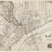
Map of the City of Bangor, Penobscot County, Maine, 1853
- Item sets
- Maps of Bangor, Maine, 1834-1956
- Title
- Map of the City of Bangor, Penobscot County, Maine, 1853
- Is Part Of
- Bangor Public Library Special Collections
- Date
- 1853
- Description
- Photographic reproduction of a wall-size map showing Bangor, Maine, and part of Brewer, Maine. Scale 33.7 feet to the inch (on original). Shows names of property holders and election districts. Includes illustrations of Unitarian Church, Union St. and Bangor House. "Published under the Patronage of the City Government; Henry F. Walling, Civil Engineer ... S. S. Smith, Publisher, 17 West Market Square, Bangor."
- Spatial Coverage
- Bangor (Me.)
- Type
- Maps
- Format
- 11 x 14 inches
- Language
- English
- Rights
-
