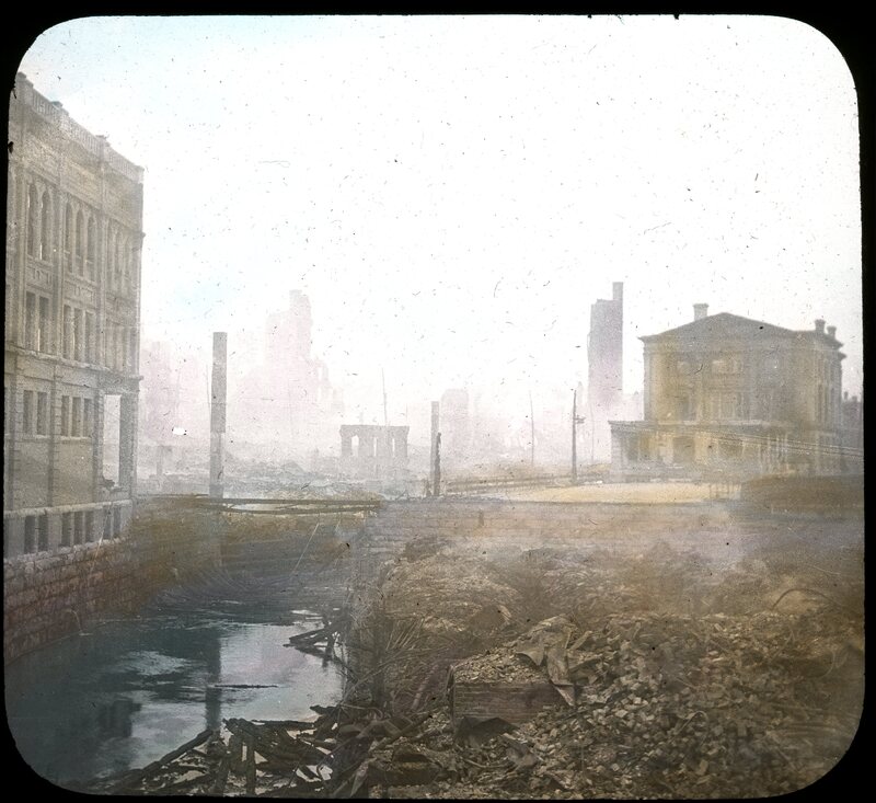
Hand-colored lantern slide showing the Graham Building on the left, and the ruined plot where Norombega Hall stood in the foreground. Behind that is the Federal Building, and in the distance the Morse-Oliver and Stearns buildings. The image was taken from Franklin Street.
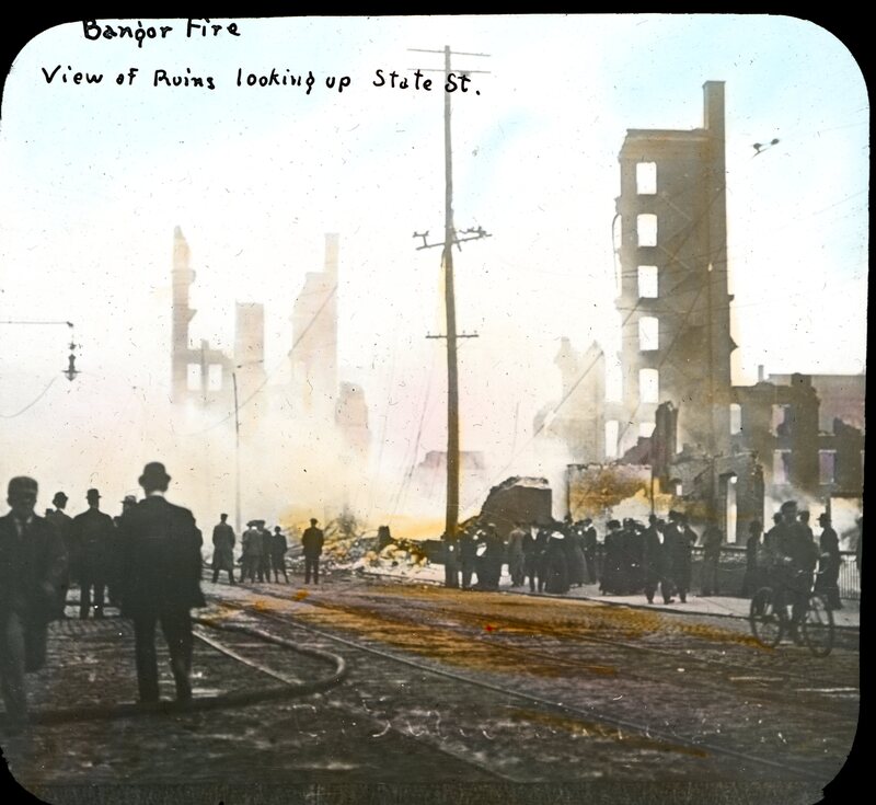
Possibly this picture was taken as the ruins still smoked; the left foreground of the image shows a fire hose snaking over the trolley tracks. Spectators, including one on a bicycle, are out to view the ruins of the Morse-Oliver building on the left, and of the Stearnes building on the right.
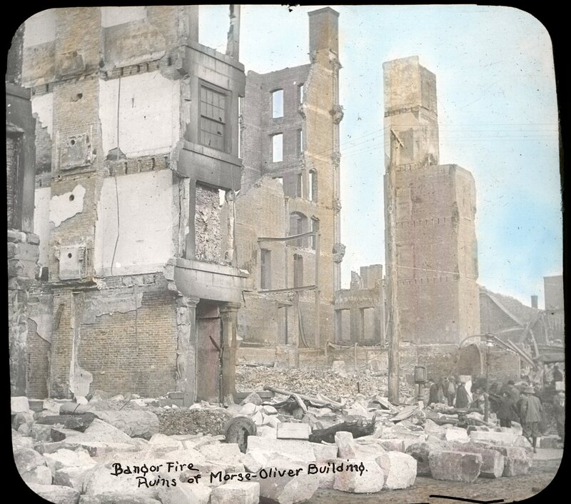
The ruins of the seven-story Morse-Oliver building on Exchange and State Streets after the Bangor Fire. The building housed many businesses, including F.H. Clifford, advertisement writers; Tyler, Fogg & Co, bankers, brokers, and safe dealers; American Realty Co, loggers; the Hamlin Lumber Co.; the headquarters of the Bangor & Aroostook Railroad and of Northern Telegraph Co, several real estate agents and appraisers; stenographers, and various others. The hand-colored lantern slide is captioned "Bangor Fire Ruins of Morse-Oliver Building."
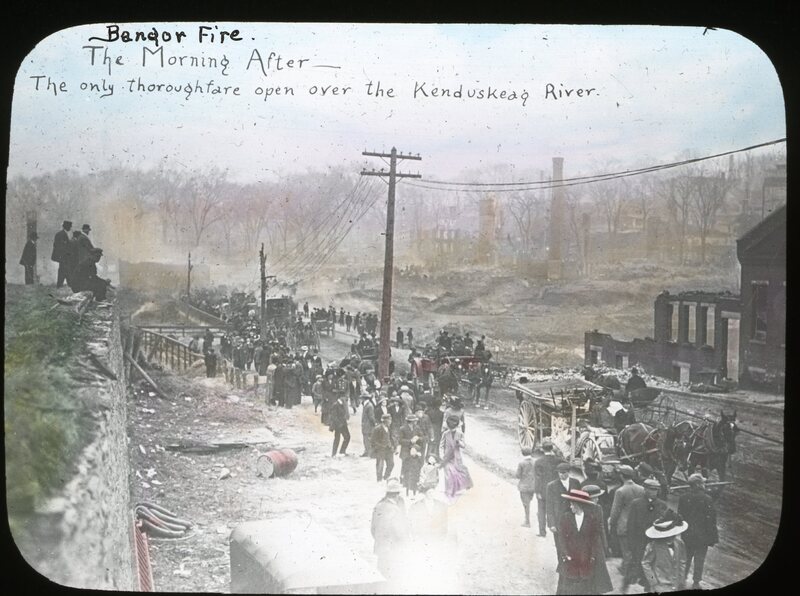
In the wake of the fire, which was only contained after midnight by hastily erected fire walls, most of downtown Bangor was left in ruins. As investigators evaluated the remains, traffic was directed to Franklin Street. "Bangor Fire the morning after the only thoroughfare open over the Kenduskeag Stream" is written on this lantern slide.
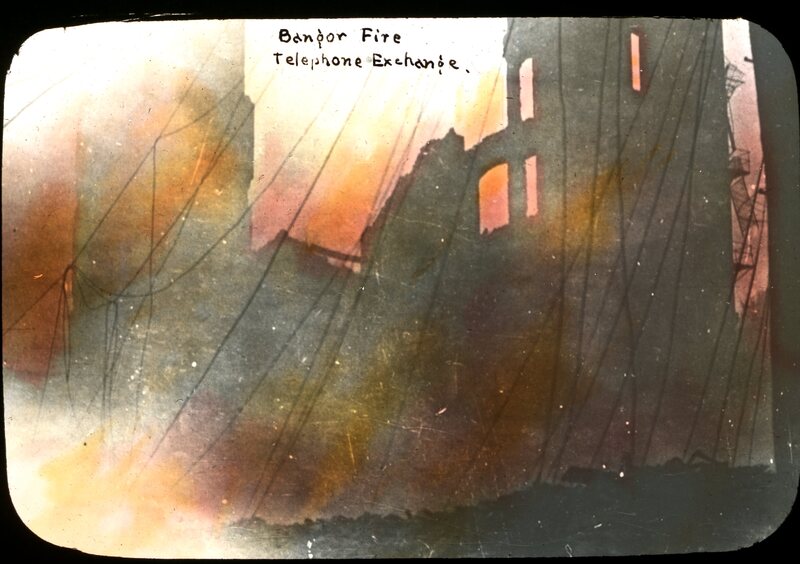
Hand-colored lantern slide showing the New England Telephone & Telegraph Co. at 45 Hammond Street, one of the first buildings to catch after the fire jumped the Kenduskeag Stream early in the afternoon. Newspapers reported that the girls who operated the switchboard stayed until almost the last minute, and that the last message sent out was a request to Boston that a replacement switchboard be sent as soon as possible. The destruction of the Exchange hampered communication from Bangor to other communites from the outset of the fire. Sensationalist New York newspapers reported that daring young men climbed to the burning roof to manually splice into the wire, stories which the Bangor Daily dismissed as an example of overwrought big-city journalism. The spiderweb of lines in the foreground demonstrates the extent of the damage to a central dispach.
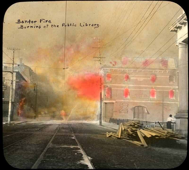
This hand-colored lantern slide shows the Bangor Public Library and the Historical Society burning during the fire of 1911. The pile of lumber hints at the scale of destruction; many blocks in the buisiness section were lost, and the conflagration has clearly spread in the background. The trolley tracks are also shown.
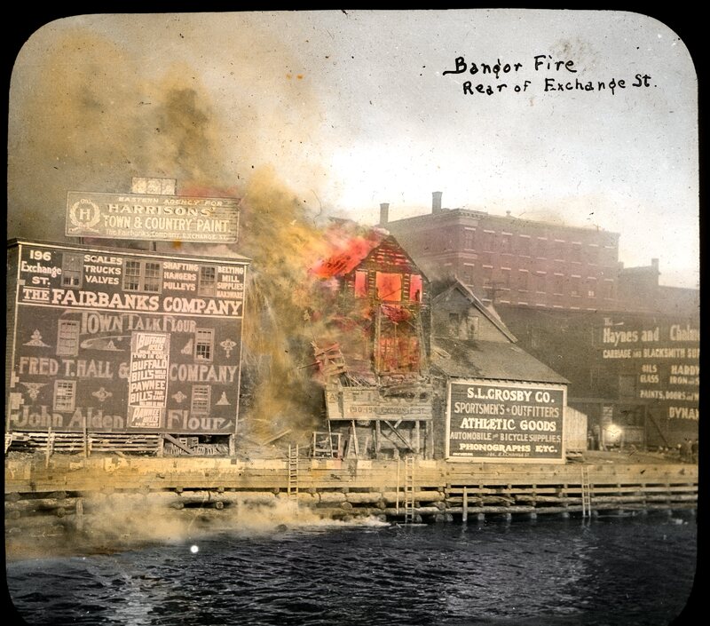
This view shows the fire in progress next door to S. L. Crosby Co, sporting goods, 136 Exchange Street. Haynes & Chalmers Hardware Store, 176 & 178 is to the right of the fire. The Fairbanks Company, 208 Exchange Street, is on the left. This colored slide reads "Bangor Fire 1911, Fairbanks Building - Rear of Exchange Street."
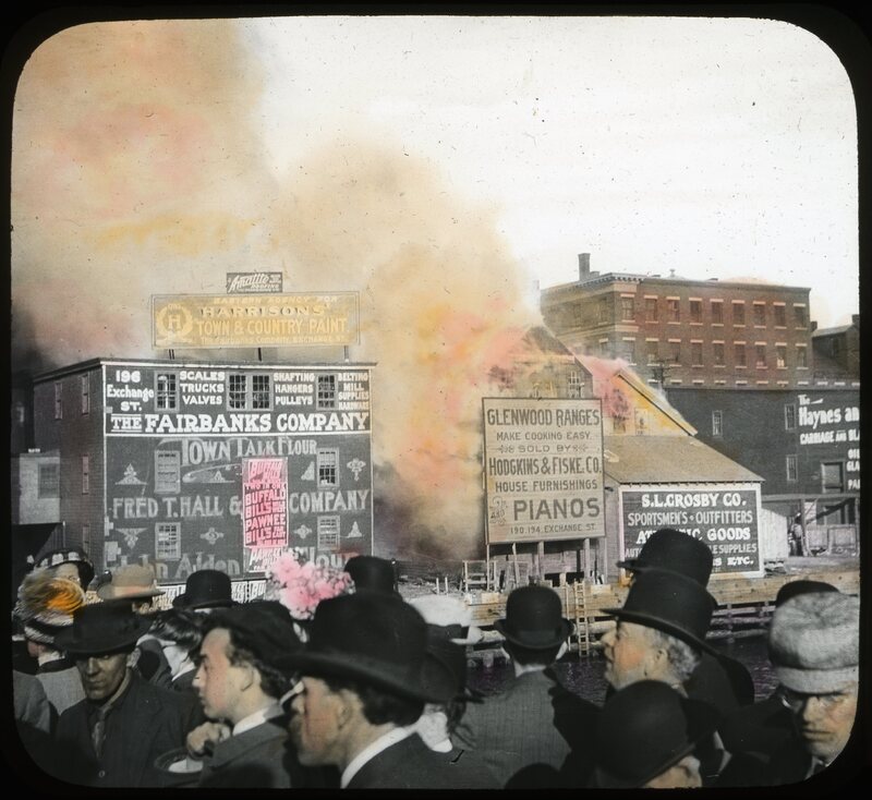
A colored slide showing the Bangor Fire in progress taken near the river. The Fairbanks Company, 208 Exchange Street, is on fire as well as Hodgkins & Fiske Co, 190-194 Exchange Street, dealers in furniture, carpets, rugs, pianos, stoves, etc. S. L. Crosby Co, 136 Exchange Street, and Haynes & Chalmers, 176 & 178 Exchange Street, can be seen to the right of fire. A group of businessmen are gathered along the waterfront.
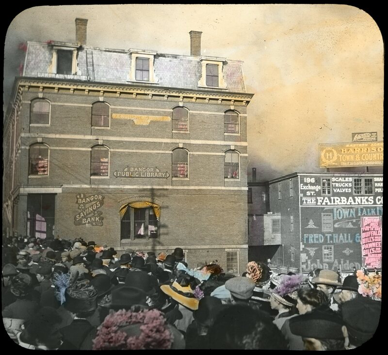
This hand-colored lantern slide shows the Bangor Public Library catching fire in 1911. The library's collection, valued at $300,000, as well as that of the Bangor Historical Society, was entirely lost. Also pictured are the Bangor Savings Bank and Fred T. Hall & Co, grocers. Many of the spectators are still dressed in their Sunday best.
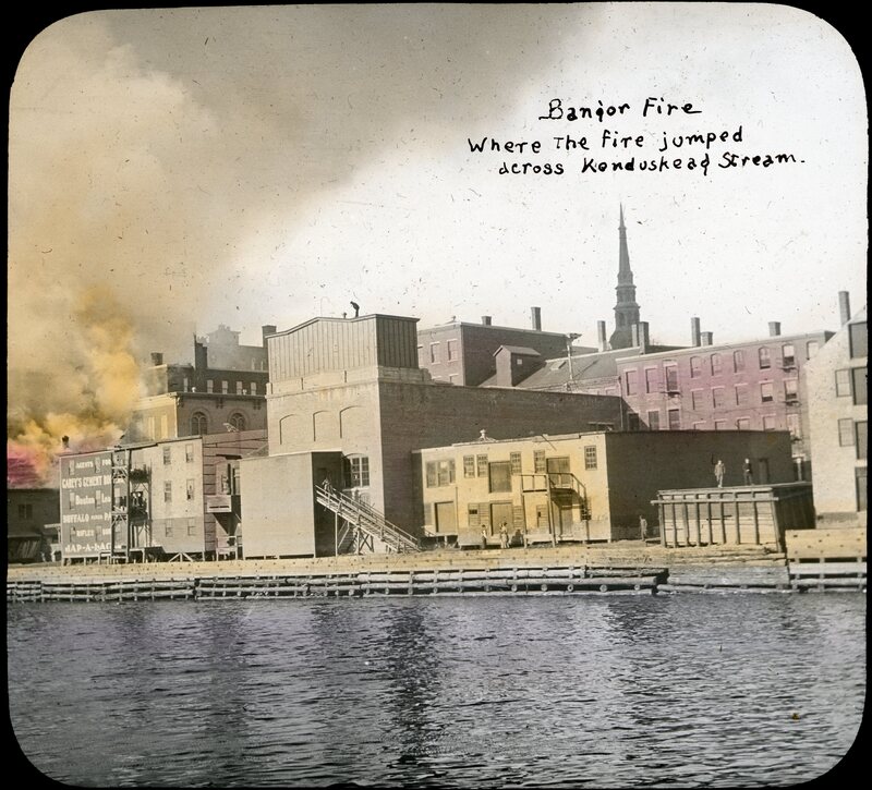
This hand-colored slide shows where the Bangor Fire jumped the Kenduskeag Stream, born along by a strong breeze. The Stetson Building was one of the first to catch fire. The Stetson building was located at 180-182 Exchange street.
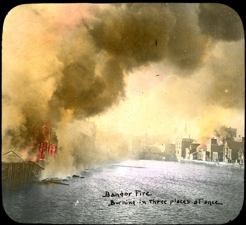
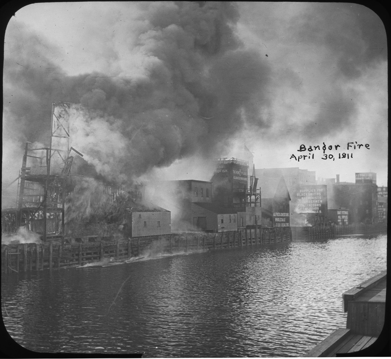
Hand-colored lantern slide showing how the Bangor Fire spread. The initial starting point of the fire, in J. Frank Green's hay shed, is in the foreground on the left. Born by strong gusts, the flames jumped the Kenduskeag Stream an hour later, igniting much of the downtown and wealthy residental districts, visible on the right. Later in the evening, the fire leapt back across the Kenduskeag, but the consruction of a fire wall and strategic dynamiting of several buildings stopped its further advance, visible in the left background. This image shows the severity of the fire; residents in Bar Harbor reported seeing a column of smoke, and inhabitants of Brunswick claimed to have seen an orange glow in the sky from a hundred miles away.
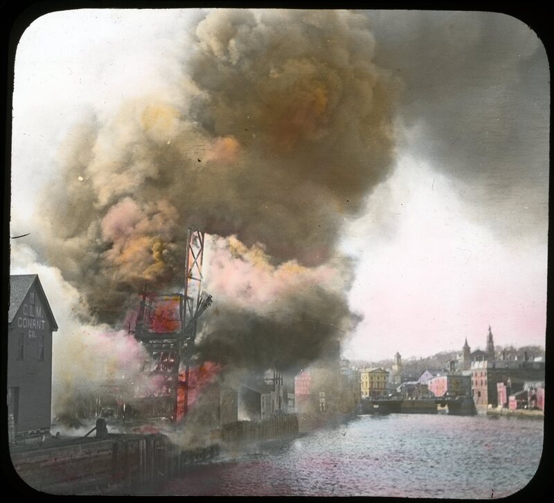
Hand-colored lantern slide taken from the Maine Central Railroad Bridge of the Bangor Fire shortly after its ignition. To the left is the C. M. Conant Company, at 194 and 196 Broad Street, dealers in agricultural implements, seeds, wagons, etc.
This is the area where the Bangor Fire started in a hay shed belonging to J. Frank Green on lower Broad Street. It is theorized that participants in an impromptu poker game dropped a cigarette and started the blaze in the afternoon. The fire quickly leapt over the Kenduskeag Stream and wreaked havoc downtown throughout the evening. "View from Railroad Bridge" is written on the image.
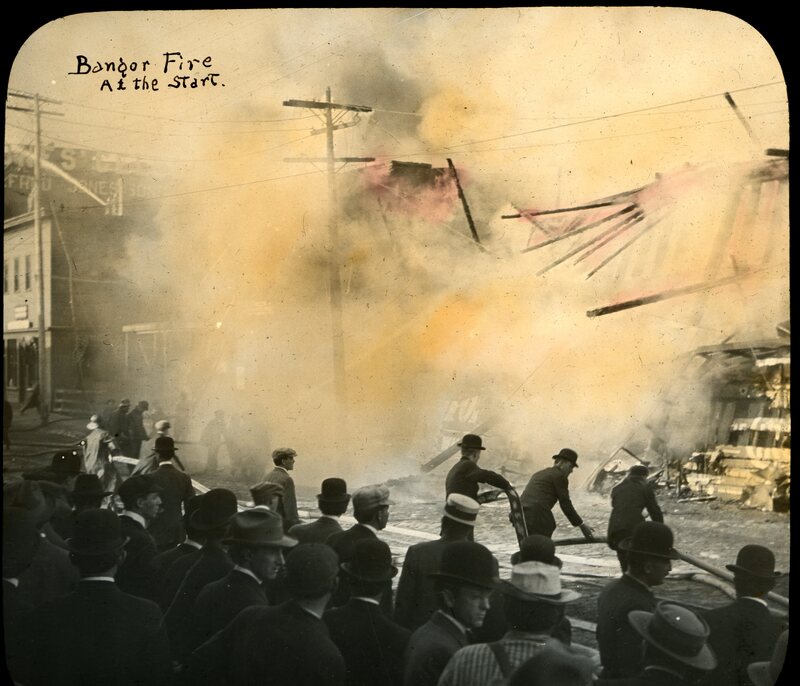
Hand-colored lantern slide showing J. Frank Green's hay shed as the walls collapsed at the start of the Bangor Fire. Firefighters and citizens are helping with the fire hoses.
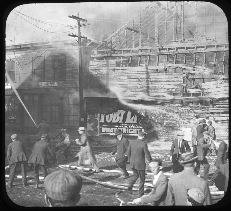
Firefighters pour streams of water on businesses on lower Broad Street where the fire broke out, including J. Frank Green's hay shed (the start of the blaze) and Northern Manufacturing Co., paint manufacturers located at 164 Broad Street. This slide is labeled "Bangor Fire, the start on Broad Street"
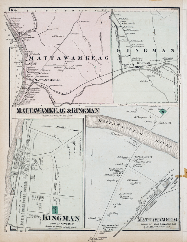
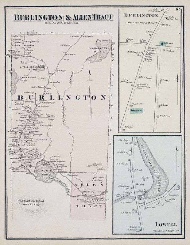
Map of Mattawamkeag and Kingman in Penobscot County, Maine. Scale 300 rods to the inch. Includes detail maps of Town of Kingman and Town of Mattawamkeag.
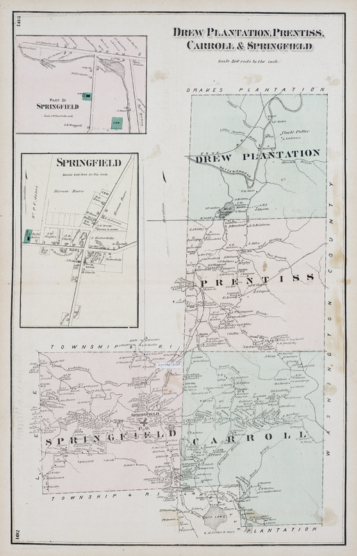
Map of Drew Plantation, Prentiss, Carroll, and Springfield in Penobscot County, Maine. Scale 300 rods to the inch. Includes detail map of part of Springfield.
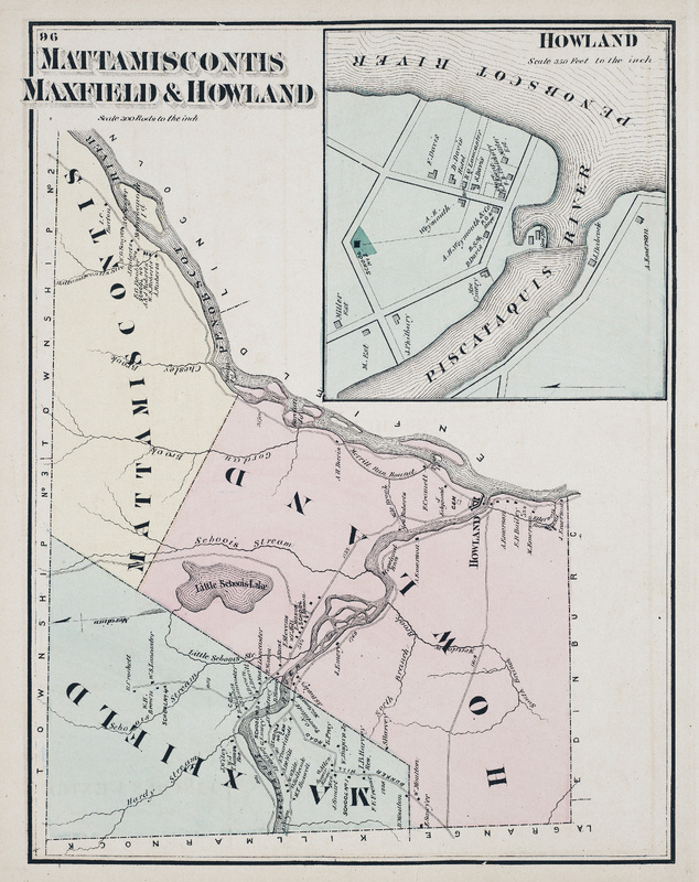
Map of Mattamiscontis, Maxfield, and Howland in Penobscot County, Maine. Scale 300 rods to the inch. Includes detail map of Howland at the convergence of the Penobscot and Piscataquis Rivers.