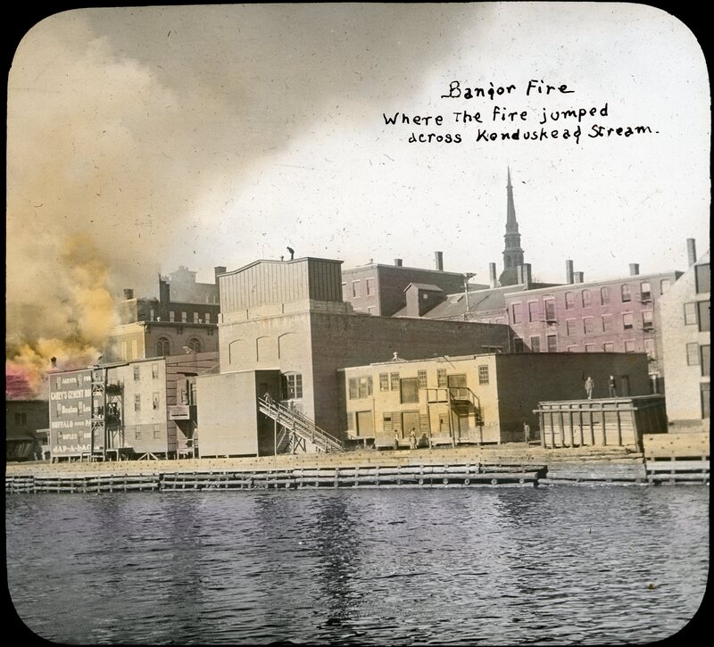
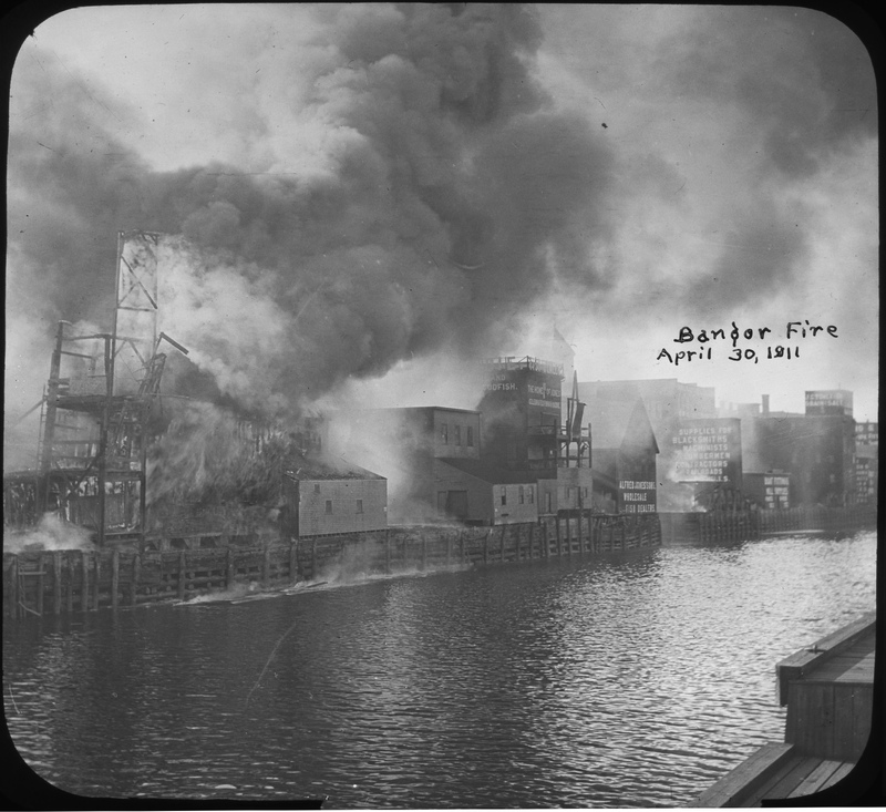
This hand-colored slide shows where the Bangor Fire jumped the Kenduskeag Stream, born along by a strong breeze. The Stetson Building was one of the first to catch fire. The Stetson building was located at 180-182 Exchange street.
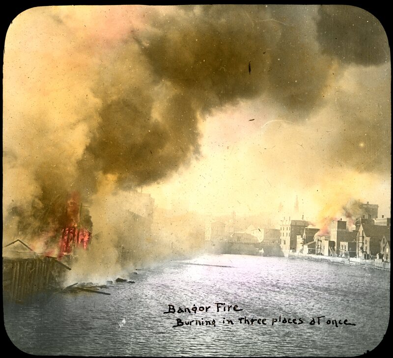
Hand-colored lantern slide showing how the Bangor Fire spread. The initial starting point of the fire, in J. Frank Green's hay shed, is in the foreground on the left. Born by strong gusts, the flames jumped the Kenduskeag Stream an hour later, igniting much of the downtown and wealthy residental districts, visible on the right. Later in the evening, the fire leapt back across the Kenduskeag, but the consruction of a fire wall and strategic dynamiting of several buildings stopped its further advance, visible in the left background. This image shows the severity of the fire; residents in Bar Harbor reported seeing a column of smoke, and inhabitants of Brunswick claimed to have seen an orange glow in the sky from a hundred miles away.
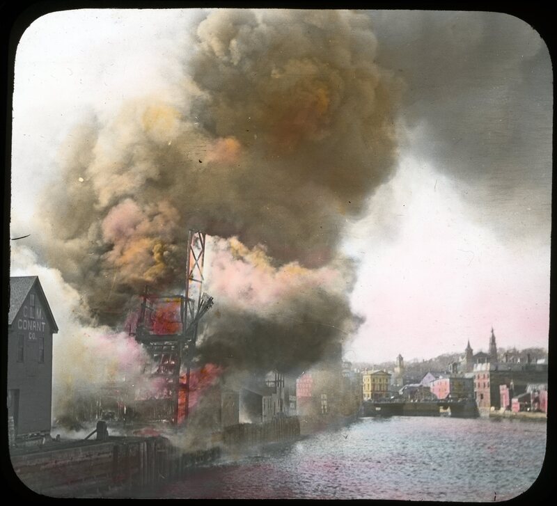
Hand-colored lantern slide taken from the Maine Central Railroad Bridge of the Bangor Fire shortly after its ignition. To the left is the C. M. Conant Company, at 194 and 196 Broad Street, dealers in agricultural implements, seeds, wagons, etc.
This is the area where the Bangor Fire started in a hay shed belonging to J. Frank Green on lower Broad Street. It is theorized that participants in an impromptu poker game dropped a cigarette and started the blaze in the afternoon. The fire quickly leapt over the Kenduskeag Stream and wreaked havoc downtown throughout the evening. "View from Railroad Bridge" is written on the image.
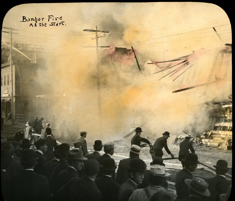
Hand-colored lantern slide showing J. Frank Green's hay shed as the walls collapsed at the start of the Bangor Fire. Firefighters and citizens are helping with the fire hoses.
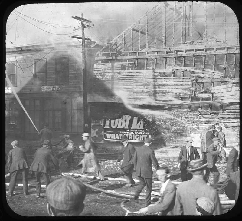
Firefighters pour streams of water on businesses on lower Broad Street where the fire broke out, including J. Frank Green's hay shed (the start of the blaze) and Northern Manufacturing Co., paint manufacturers located at 164 Broad Street. This slide is labeled "Bangor Fire, the start on Broad Street"
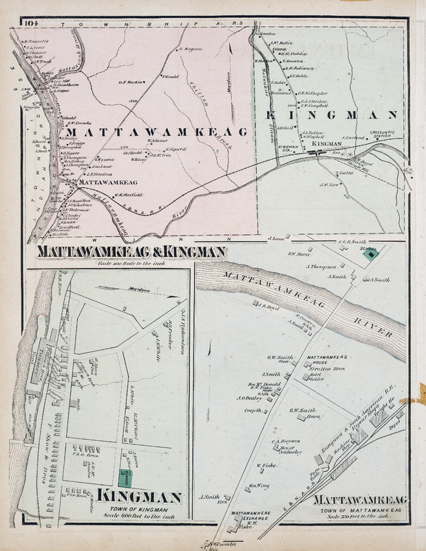
Map of Mattawamkeag and Kingman in Penobscot County, Maine. Scale 300 rods to the inch. Includes detail maps of Town of Kingman and Town of Mattawamkeag.
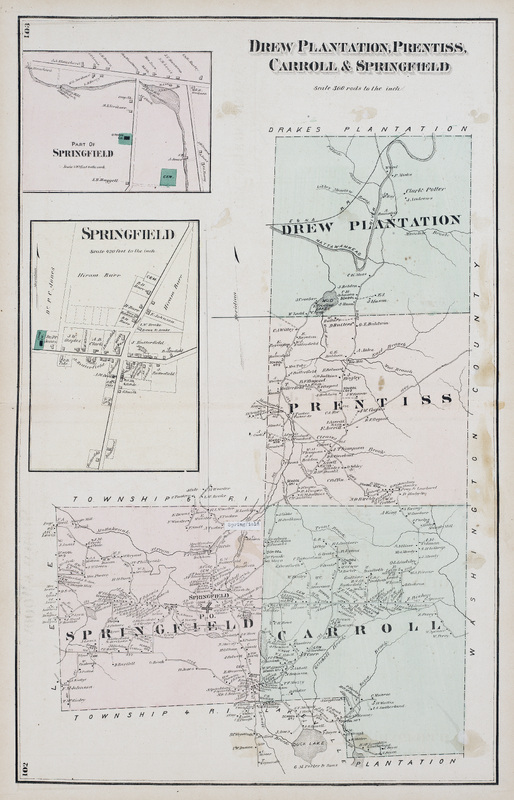
Map of Drew Plantation, Prentiss, Carroll, and Springfield in Penobscot County, Maine. Scale 300 rods to the inch. Includes detail map of part of Springfield.
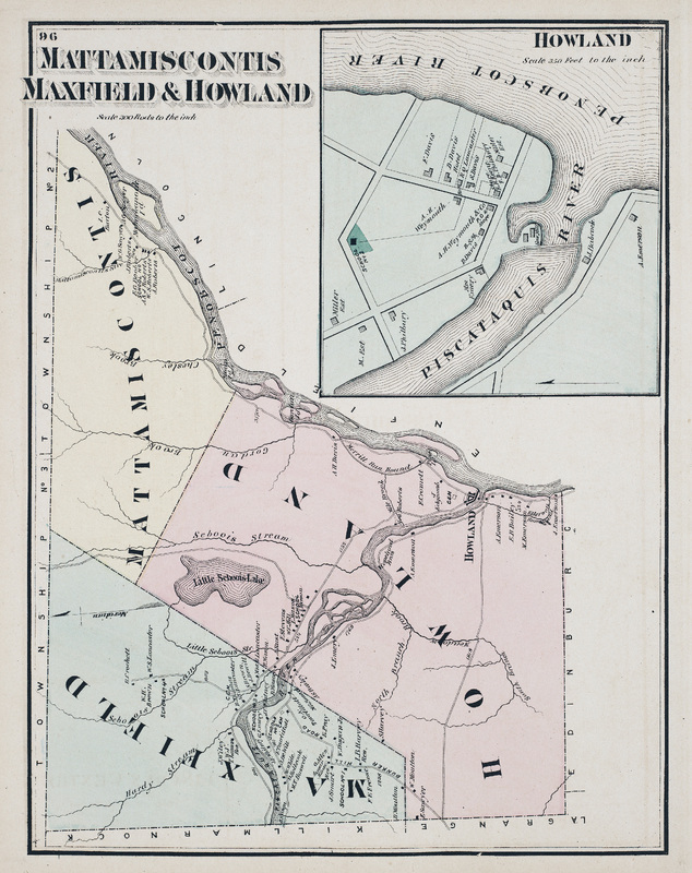
Map of Mattamiscontis, Maxfield, and Howland in Penobscot County, Maine. Scale 300 rods to the inch. Includes detail map of Howland at the convergence of the Penobscot and Piscataquis Rivers.
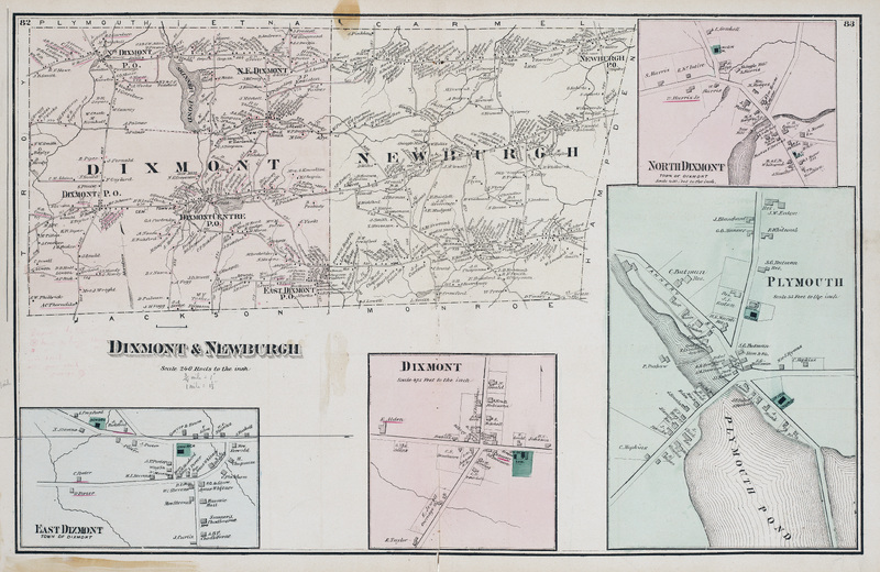
Map of Dixmont and Newburgh in Penobscot County, Maine. Scale 240 rods to the inch. Includes detail maps of North Dixmont, East Dixmont, Dixmont, and Plymouth.
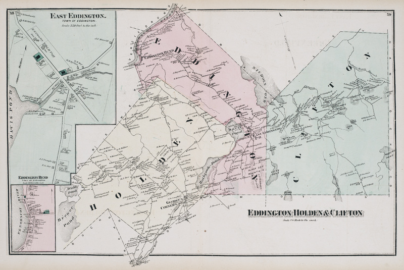
Map of Eddington, Holden, and Clifton in Penobscot County, Maine. Scale 240 rods to the inch. Includes detail maps of East Eddington and Eddington Bend.