

Mount Katahdin in Maine
- Item sets
- Maine Description and Travel, 1876-1974
- Title
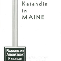
- Mount Katahdin in Maine
- Date
- 1930
- Description
- Facts at a Glance: Mount Katahdin is 5,273 feet above sea level. Mount Katahdin is one of the three highest mountains facts east of the Rockies. Mount Katahdin is reached by the Bangor and Aroostook rail road from Norcross, Millinocket and Stacyville stations. Mount Katahdin also can be reached by the Bangor and Aroostook railroad to Greenville, thence overland to the Penobscot's West Branch and down the West Branch to Abol stream 12 miles below Ripogenus. Still another route is from Ripogenus dam by road to Harrington Lake; across the lake to Kidney Pond and thence by the Hunt Trail to Mt. Katahdin. Mount Katahdin has attractions that provide a program for a prolonged stay by the enthusiast. The minimum trip is two days, a day in the ascent, overnight on the mountain and return the second day. The Mt. Katahdin country, the vast expanse over which Katahdin dominates, is one of the outstanding sections of the Maine woods for fishing and hunting and canoeing and for general vacation pleasures. Mount Katahdin offers opportunities for exceptional sport for the devotee of mountain climbing. Its variety of approaches and routes offers relatively easy traveling or some sporty scrambling, depending upon choice of the mountaineer planning to make the ascent.
- Spatial Coverage
- Piscataquis County (Me.)
- Language
- English
- Is Part Of
- Bangor Public Library Special Collections
- Note
- Contains photographs, trail maps, and narrative descriptions of trails.
- Rights
-
